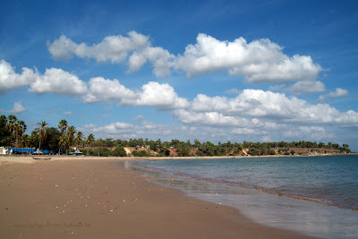
Rabu, 28 Maret 2012

Danau Sentani, Jayapura District, Papua, Indonesia

Danau Sentani, Jayapura District, Papua, Indonesia

Sentani lake beneath in the slope Cycloops Mountains Nature Reserve has an area of ​​approximately 245.000 hectares, which lies between the City and District Jayapura Jayapura, Papua. Sentani lake has an area of ​​approximately 9.360 hectares and is located at a height of + 75 meters above sea level, is one of the largest lake in Papua. Lake Sentani potential for the development of aquaculture water tawar.untuk family nutrition and a source of local revenue.
With the potential for large-scale flow of water, the lake can be used as cropland Sentani different types of freshwater fish, which will be able to meet market demand in Papua even to get out of Papua. Lake Sentani be for many aquaculture species such as freshwater fish Oreochromis mossambicus, Mas, Catfish, Tilapia, and various other types of high protein fish.

(source: www.wisatanesia.com)

Pantai Amai, Jayapura City, Papua, Indonesia

Pantai Amai, Jayapura City, Papua, Indonesia

Pantai Amai is a beach that has a white sand beaches, crystal clear water and very attractive, decorated with freshwater estuaries on the coast is clear, and comes to rest huts, many tourists come to this beach for bathing and basking in the heat of the sun's heat .
 This beach is located in District 5 km from the beach Depapre Depapre Jayapura. Amai beach attraction is the beach meeting with the Salt Water Fresh Water. Amai Beach attraction is perfect for weekend trips with the family.
 (source: www.wisatanesia.com)

Senin, 26 Maret 2012

Pantai Tanjung Pesona, District Sungailiat, Bangka Belitung, Indonesia

Pantai Tanjung Pesona, District Sungailiat, Bangka Belitung, Indonesia

Pantai Tanjung Pesona is located in the Village Charm Rambak, District Sungailiat. Located 9 km from the city Sungailiat Bangka regency. The beach is located in the middle place between Teluk Uber beach and Tikus Beach. This beach has a panoramic view of the high seas, on a promontory with a large rock. The beach is also equipped with tourist facilities, with the classification of three-star hotel.
If you look at the sea, this beach has beautiful scenery, the sea is calm enough to swim, but unfortunately if you look to the edge of the beach is not natural and was impressed not maintained anymore. For those of you who want to enjoy the sea breeze under the trees, the beach is good enough to visit.
 (source: www.wisatanesia.com)

Minggu, 25 Maret 2012

Kaieteur Falls, Potaro-Siparuni Region, Guyana

Kaieteur Falls, Potaro-Siparuni Region, Guyana

Kaieteur Falls is a high-volume waterfall on the Potaro River in central Guyana, Potaro-Siparuni region. It is located in Kaieteur National Park. It is 226 meters (741 ft) high when measured from its plunge over a sandstone and conglomerate cliff to the first break. It then flows over a series of steep cascades that, when included in the measurements, bring the total height to 251 meters (822 ft). While many falls have greater height, few have the combination of height and water volume. This has given Kaieteur Falls the misleading label of "largest single drop" waterfall in the world which is often misinterpreted as "tallest single drop." However, it is likely one of the most powerful waterfalls in the world.
Kaieteur Falls is about five times higher than the more well known Niagara Falls, located on the border between Canada and the United States and about two times the height of the Victoria Falls located on the border of Zambia and Zimbabwe in Africa. It is a single drop waterfall which is the 123rd tallest (single and multi-drop waterfall) in the world, according to the World Waterfalls Database. The same web site lists it as 19th largest waterfall in terms of volume, and in their estimation, Kaieteur is the 26th most scenic waterfall in the world.

(source: www.where-is-this.com; www.wikipedia.org)

Pantai Takisung, Banjarmasin, South Kalimantan, Indonesia

Pantai Takisung, Banjarmasin, South Kalimantan, Indonesia

Pantai Takisung is located in District Takisung the district west of Sea Land. Is approximately 22 km from the city Pelaihari or approximately 87 miles from the South Kalimantan capital of Banjarmasin. Although the Coast Takisung is the Java Sea, but the waves were not huge like the south coast of Java. Making it safe for a tourist and residential areas.
As a tourist attraction, can be classified Takisung Coast beaches are enchanting sights with a view of the beach surrounded by palm trees with brown sand like sea water (for identification of the water, which is obtained from observations belonging to 9 pH alkaline water with a temperature of 250C and water flow rate of 1927 rpm, while the brightness level of the water by 32 cm), accompanied by a lot of markets that sell typical beach snacks, ranging from the fish sauce, garnish clams, shrimp, fish, until the reefs directly from fishermen. Plus the District Land Sea continues polishing attraction through the construction of a number of public facilities not owned by other coastal attractions. Among them, selter, a permanent stage, restaurants, and lodging.
(source: www.wisatanesia.com)

Air Terjun Sri Gethuk, District of Gunung Kidul, Yogyakarata, Indonesia

Air Terjun Sri Gethuk, District of Gunung Kidul, Yogyakarata, Indonesia

Air Terjun Sri Gethuk or Sri Gethuk Waterfall is located in the District of Gunung Kidul, or more precisely located in the hamlet Menggoran Bleberan Village, District Playen, Gunung Kidul, Yogyakarta, approximately located about 41 km from Yogyakarta. Locations Waterfalls of Sri Gethuk remote enough so that the transportation to get there pretty hard to come by.
To get to the route in Sri Gethuk waterfall can be reached from Yogyakarta by Jl. Wonosari, until after the T-junction turn left towards Playen Ivory, from city Playen Paliyan search path to a distance of about - about 1.5 miles after that the visitors will come across the board a direction and just follow the directions to visitors to the waterfall attractions Sri Gethuk.
  
(source: www.wisatanesia.com)

Sabtu, 24 Maret 2012

Iguazú Fall, Misiones Province, Argentina Paraná (state), Brazil

Iguazú Fall, Misiones Province, Argentina Paraná (state), Brazil

Iguazu Fall are waterfalls of the Iguazu River located on the border of the Brazilian State of Paraná and the Argentine Province of Misiones. The falls divide the river into the upper and lower Iguazu. The Iguazu River originates near the city of Curitiba. It flows through Brazil for most of its course. Below its confluence with the San Antonio River, the Iguazu River forms the boundary between Brazil and Argentina.
The name "Iguazu" comes from the Guarani or Tupi words y , meaning "water", and ûasú [waˈsu], meaning "big". Legend has it that a god planned to marry a beautiful woman named Naipí, who fled with her mortal lover Tarobá in a canoe. In rage the god sliced the river, creating the waterfalls and condemning the lovers to an eternal fall. The first European to find the falls was the Spanish conquistador Álvar Núñez Cabeza de Vaca in 1541.

(source: www.where-is-this.com; www.wikipedia.org)

Curug Sibedil, Pemalang, Central Java

Curug Sibedil, Pemalang, Central Java
Curug Sibedil is a waterfall located in the District Rongga, Pemalang, Central Java. It's very easy to reach Curug Sibedil cause it just a few meters from the road. Remember that there is no road yet to access the waterfall so we need to go through a river. The panorama that is given was incredible.  The waterfall which is 10 meters high only has great views plus a cool atmosphere around the waterfall.
Curug Sibedil attraction is that there's many of waterfalls around and even around the waterfall is full of tiny fountain, which makes good in view of this waterfall. A fairly clean water to make a people can not wait to swim. But you must remember this waterfall is not the major tourist attractions so its authenticity is still well preserved.
 (source: www.wisatanesia.com)

Jumat, 23 Maret 2012

Candi Gedong Songo, Ambarawa, Central Java, Indoonesia

Candi Gedong Songo, Ambarawa, Central Java, Indoonesia

Gedong Songo is a temple complex at the foot Gunun Ungaran, precisely at the Village Temple, District Ambarawa within 9 miles of the city Ambarawa and 12 km from the city Ungaran. Discovered in 1804 by Raffles Gedongsongo Temple is one of the Hindu cultural heritage from the time of Sanjaya dynasty in the ninth century (AD 921 years).
 It is also natural attractions with the cool air and beautiful natural scenery is also equipped with a hot spring, camp area tours, horseback riding, natural and artificial rock climbing rides. Around the site there is also Lodging and hotel.
 (source: www.wisatanesia.com)

Maya Bay, Phi Phi Island, Thailand

Maya Bay, Phi Phi Island, Thailand

Maya Bay is a stunningly beautiful bay that's sheltered by 100-metre high cliffs on three sides. Inside the bay there are several beaches, most are small and some only exist at low tide. The main one is around 200 metres long with silky soft white sand, underwater colourful coral and exotic fish in exceptionally clear water; the whole bay is one big reef.

Maya Bay has become the main tourist attraction of Phi Phi since The Beach was filmed here in 1999. It was always very popular before the film but now people around the world who haven't even heard of Phi Phi have certainly heard of Maya Bay.

The best time to visit Maya Bay is between November and April during the high season when seas are calm and access to the bay is easy. Rough seas from May to October may hinder access but rarely deny entry.

(source: www.panoramio.com; www.phuket.com)

Pulau Panjang, Jepara, Central Java, Indonesia

Pulau Panjang, Jepara, Central Java, Indonesia

Pulau Panjang located to the west of Pantai Kartini which is about 1.5 km, is a gently sloping coastal islands and white sand. The island is lush because several types of trees grown there. The high tree are very attractive to many species of birds (gulls, herons, blekok) to live and breed there.

Visitors can explore the island by walking along the beach or along the road (block paving) while enjoying the scenery on either side. In addition, white sandy beaches and shallow waters with coral reefs is also the scene of considerable interest, especially for those who like fishing and sea bathing.
 
Pulau Panjang also has the tomb of Islam leader (a teacher), Sheikh Abu Bakar is the name. There is also a lighthouse that still serves to guide the ships that sailed the Java Sea.

To get to Long Island to take advantage of boat tours from Pantai Kartini or Pantai Bandengan with relatively low prices. For those who want to camp not to worry, because there is also provided with adequate toilet facilities.
 (source: www.wisatanesia.com)

Pantai Tanjung Ular, West Bangka, Bangka Belitung, Indonesia

Pantai Tanjung Ular, West Bangka, Bangka Belitung, Indonesia

Pantai Tanjung Ular are more or less about 15 km from the city Muntok West Bangka regency. A winding path along the 5 km to get to the beach attractions is like a serpent, that's why its named as Pantai Tanjung Ular or Cape Coast Snake. For now the snake attraction cape coast is not yet available facilities such as toilets, etc., but soon enough the government will build it. All visitors bring their own all their needs.
  For the foreseeable future coastal headlands snake could potentially be developed into beach resorts, as well as access road to the coastal headlands and the snake was there and was quite wide, though not in aspal.Just wait to see the seriousness of the local government to develop attractions. Pantai Tanjung Ular is perfect for weekend trips with the family.
 (source: www.wisatanesia.com)

Rabu, 21 Maret 2012

Pantai Lasiana, Kupang, East Nusa Tenggara, Indonesia

Pantai Lasiana, Kupang, East Nusa Tenggara, Indonesia

Pantai Lasiana opened to the public sometime in 1970's. Pantai Kupang is located in the Central Kupang District, city of Kupang, East Nusa Tenggara.

Since the Department of Tourism NTT "polish" it by building various facilities in 1986, Pantai Lasiana begin visited by foreign tourists. Appropriate municipal development plan of Kupang, Pantai Lasiana will be Flobamora Cultural Park, the designation refers to the whole tribe near the beach Lasiana, among others, Flores, Sumba, Timor and Alor.

On the beach, many found Lasiana lopo lopo-lined. Lopo-lopo is the local name for the lodge that was built like an umbrella with a pole of wood or coconut tree trunk and palm thatched roof, coconut or palm bark, and reeds. Can also open to the exterior zinc-coated fibers, coconut bark or papyrus and reeds.
 (source: www.wisatanesia.com)

Bridal Veil Waterfall in the Geirangerfjord, Norway

 
 Bridal Veil Waterfall in the Geirangerfjord, Norway

The Geiranger Fjord (Norwegian: Geirangerfjorden) is a fjord in the Sunnmøre region of Møre og Romsdal county in Norway. It is in the municipality of Stranda. It is a 15-kilometre (9.3 mi) long branch of the Storfjord (Great Fjord). The small village of Geiranger is located at the end of the fjord where the Geirangelva river empties into it.

The fjord is one of Norway's most visited tourist sites and has been listed as a UNESCO World Heritage Site, jointly with Nærøyfjord, since 2005, although this status is now threatened by the disputed plans to build power lines across the fjord. A car ferry, which doubles as a sightseeing trip, is operated by Fjord1 Nordvestlandske.


(source: www.wikipedia.org; www.where-is-this.com)

Selasa, 20 Maret 2012

Pantai Sulamadaha, Ternate, North Maluku, Indonesia

Pantai Sulamadaha, Ternate, North Maluku, Indonesia

Pantai Sulamadaha is approximately less than 14 miles from downtown Ternate. Pantai Sulamadaha is easily accessible by public transport or private vehicles.

Pantai Sulamadaha offers a beautiful natural feel that is able to eliminate the fatigue of every person who visited It. Sand and waves, blue ocean, and the scenery around the island of Hiri the rocks and trees.

Pantai Sulamadaha into a tourist attraction that targeted residents on holidays. From the central coast of Ternate to take an hour trip. Pantai Sulamadaha still presents a view of nature and atmosphere of the original. In fact, the food sold on the beach is very traditional. Sellers built a small tent on the beach to sell young coconuts and snacks.

Pantai Sulamadaha is not as well known beaches in Bali. Although it is not white sand, Pantai Sulamadaha has its own charm. This black sand beach directly opposite the island of Hiri.
 (source: www.wisatanesia.com)

Pulau Beras Basah, Bontang, East Kalimantan, Indonesia

Pulau Beras Basah, Bontang, East Kalimantan, Indonesia

Beras Basah is the name of an island in the urban area Bontang. An islands with white sand beach is an attractive place for recreation while enjoying the panoramic beauty of the sea strait of Makassar, tourists can swim and breathe in the cool sea air. Pulau Beras Basah can be achieved by using a Speed ​​Boat or motor boat from the Port of Tanjung Sea, Bontang to get there. The distance is only 5 miles or about 8 km from the Boat House [base speed boat in the Marina area Bontang] to within 15 to 20 minutes.
  
(source: www.wisatanesia.com)

Pantai Nambo, Kendari, Southeast Sulawesi, Indonesia

Pantai Nambo, Kendari, Southeast Sulawesi, Indonesia

Pantai Nambo is a beautiful beach which was about ± 12 km from the city of Kendari, or about 15 minutes towards the southern city of Kendari by using a two-wheel or four-wheel drive and can also use a traditional boat ketinting (kole-kole) about 15 minutes from the port city of Kendari along the Kendari bay( Teluk Kendari ). The beach is attractive and attract more visitors because of its place was near. Nambo's white sand beach has a gentle atmosphere of calm, cool weather and a stunning panorama that this place is always a choice the people of Turkey to remove the boredom and the daily routine on the weekends, this place has provided a parking lot, gazebo, where rinse bath and traditional traders offering various types of merchandise.


(source: www.kendarikota.go.id; www.egenamaku.wordpress.com)

Pantai Tanjung Kasuari, Sorong, West Papua, Indonesia


Pantai Tanjung Kasuari, Sorong, West Papua, Indonesia

Pantai Tanjung Kasuari is located in the city of Sorong, West Papua Province in Indonesia. These beautiful beach has become one of the main recreation area most frequented by the people almost every day, either from Sorong or from outside Sorong.

Pantai Tanjung Kasuari is about 7 km from downtown of Sorong City. Pantai Kasuari can be reached by four wheel vehicle and a motorcycle. For people who don't have a vehicle, there is also public transportation to the Pantai Tanjung Kasuari.

The cool air, a pretty white sand, sea water is quite clear, and many palm trees around a stretch of beach make the people in Sorong and the surrounding area are pleased to go there. Moreover  recreation in the evening or on weekends.
 

(source: www.wisatanesia.com; www.travel.detik.com)

Senin, 19 Maret 2012

Mount Paku, Tairua, New Zealand


Mount Paku, Tairua, New Zealand
 
Tairua is a beautiful surf town located on the east coast of Coromandel Penninsula.

The volcanic peak, Paku, and offshore views of Slipper, Shoe and the jagged Aldermen Islands are the natural focal points of the Tairua area.
Large areas south of Tairua River, between Pauanui and Wharekawa Harbour (Opoutere), are dominated by exotic forests.
North of Tairua is the rugged coastal area of Sailors Grave - an area for a fine half-day coastal walk.
Inland, the Tairua River runs to the sea from its source in the Coromandel Range, snaking through historical Broken Hills on its journey.
Charter and fishing boats operate from the Tairua Wharf.
The beaches here are perfect for safe swimming and surfing.

Mt Paku

Mt Paku is a twin-coned volcanic peak that dominates the head of the Tairua Harbour. A Maori pa sculptures the hillside.
Once an island, Paku can be climbed from Paku Drive, in a steep 15-minute walk to the summit. The walk offers vantage points to the Tairua Harbour, Tairua and Pauanui beaches, and the islands of Castle Rock, Mercury Islands, Aldermen Islands and Slipper and Shoe Islands.
Much of Tairua's early settler history is told on story boards along the walk.
Tairua Beach, at the bottom of Mt Paku, is the site of the earliest evidence of Polynesian settlement in New Zealand. The beach is safe for swimming and surfing.

(source: www.where-is-this.com; www.tourism.net)

Triangle Pass, Colorado, USA


Triangle Pass, Colorado, USA

Triangle Pass is the highest point of the trail at 12,980 feet connecting the Copper Creek Basin on the south and the Conundrum Creek Basin on the north side.

(source: www.where-is-this.com; www.panoramio.com)